
Routes that stay in the channel, depth at today's lake level, and every marina and boat-up restaurant with where to tie up. Drawn by a Table Rock local.
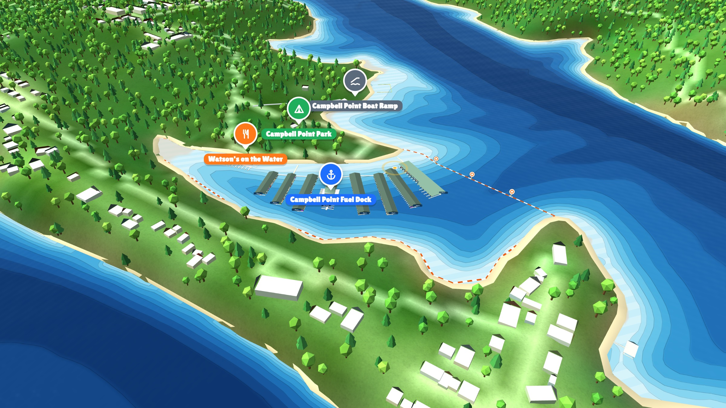
Table Rock is 800 miles of shoreline and a thousand coves that all look the same from the water. The Navigator is the friend who grew up here.
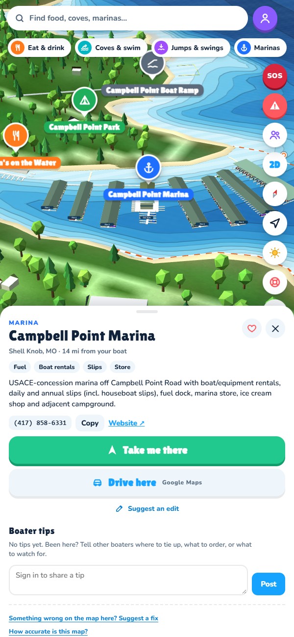
Every route follows the deep water, keeps 50 feet off the bank, steers around docks and buoy lines, and slows to idle in no-wake zones. You get the miles, the ride time and the arrival clock before you leave, then turn-by-turn on the water, with a warning if sunset comes first.
Navigation starts when your GPS puts you on the lake or at the dock. Off the water, the trip starts from your home marina so you can plan the day from the couch.
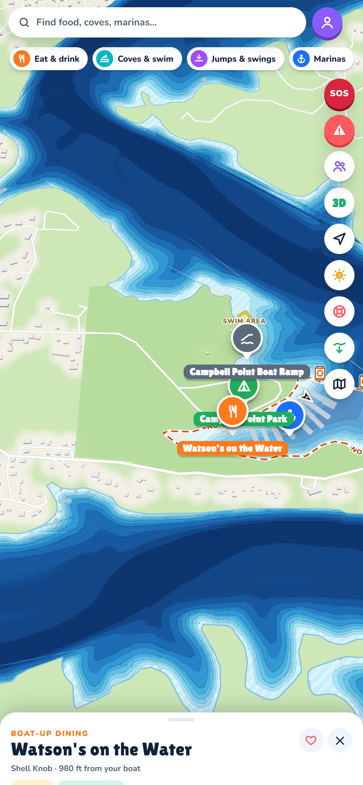
The depth colours come from the USGS 2020 sonar survey, shifted every day by the Corps of Engineers' lake level reading. A shallow-water alarm watches the bow at speed, and a depth gauge rides along on every trip.
Eleven bands from 3 to 100 feet, plus the rocks and humps the survey found, checked against the aerial photos.
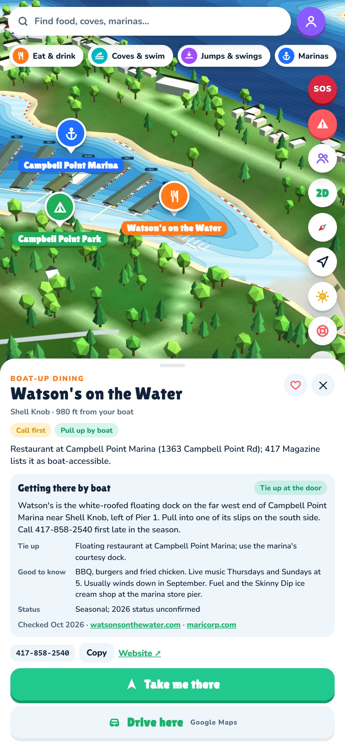
Which dock, which side, whether it's a walk or a shuttle, whether they're open this season, and one tap to get there. Ice cream stops, fuel docks and swim beaches too.
Closed for the season? It still shows, marked closed, so you know the whole lake, not just today's picks.
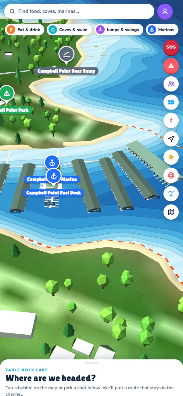
Every dock, pier, bridge, ramp and tree line is on the 3D map, built from the lake's own data. Scout a cove, find the fuel dock, see where the swim rope is, then switch to the flat map when you want the big picture.
Floating logs, shallow spots and missing buoys, reported by boaters and shown to everyone on the water within minutes. Thumbs-up keeps a report alive; silence lets it fade.
See your crew's boats while you're on the lake, and meet up at the cove instead of texting pins. It shuts off when you leave the water.
Wind, storms on the way, and a "leave by" time to get home before dark. Nav-light reminders after sunset.
Every marina with its no-wake zone drawn where the buoys actually are, plus the fuel docks, pump-outs and ramps.
Type your boat's length once and the map draws it true size, so you can see whether that gap between the docks is really a gap.
104 brush piles and structure spots from the public record, with depth at today's level.
Email in, code back, no password. Pick your home marina and your boat, and the map opens there.
Search a restaurant, tap a cove, or pick a marina. You see the route, the miles and the arrival time first.
Once your GPS puts you on the water, the trip follows your boat with turn-by-turn, depth and speed on screen.
Government surveys give you raw numbers: a sonar depth grid, a lake level gauge, a list of buoy points. They don't tell you which dock Watson's is on, where the swim rope sits, or where the rock is at the Point 9 buoy.
This map is drawn by a local who boats Table Rock. The public surveys are the starting point. The no-wake lines, the swim areas, the hazards, the places and where to tie up at each one are drawn and checked one spot at a time, and the routes are worked out over that map.
No one person can keep a thousand coves current. When you spot a log, a shallow bar, a missing buoy or a restaurant that changed hands, report it or fix the listing right in the app. Every member who does makes the map better for the next boat out.
It's free for the whole first season. No ads. Members only while we're in preview, so every report on the map comes from a real boater.
Yes, for the whole first season, with no ads. A subscription comes later, and members from the preview will hear about it first.
No. It runs in your phone's browser. On iPhone, open it in Safari and use Share → Add to Home Screen; it then opens like an app, full screen. The App Store and Google Play versions are on the way.
The map, the routes and the trip guidance work with no signal at all. Only the live lake level and the weather need one, and both fall back to the last reading.
While we're in preview the map is for members only. That keeps the hazard reports honest, keeps the servers quick, and means every tip on the map came from someone who boats here.
It's for planning and finding your way around. It isn't a replacement for watching the water, the buoys and other boats. Depths come from a 2020 survey and conditions change. Navigation only starts when your GPS puts you on the water or at the dock.
A Table Rock Lake local in Shell Knob, Missouri, who draws the map himself, through his company Stimbleworks LLC. Questions, a business listing to fix, or want your account deleted? Support is here.
Free this season. Takes a minute to join.
 Table Rock Navigator